
ALLIANCE contact: Dr Bogusław Michalik


Site overview
The Upper Silesian Coal Basin (USCB) is located in the Silesian Upland in southern Poland. The Silesian Upland is a plateau between 200 and 300 m above sea level, divided into distinct ridges by river valleys. The USCB area is affected by long term industrial activity that began in 12th century with silver mining which was followed later by lead and zinc ore exploitation. Since the turn of the 18th and 19th centuries underground coal mining, ironworks and coal fired power plants have left an imprint on the local environment.
Currently, fossil fuel and mining industries in Europe are reducing. However, within the USCB area about 30 underground coal mines are still in operation. From an environmental perspective, one of the most important sources of contamination within the USCB area is from ‘formation water’ pumped from underground mines into surface retention ponds. The daily discharge of mine waters into these ponds exceeds 400,000 m3. This volume has not significantly decreased even though many mines have closed as water must be still pumped to the surface to protect neighbouring mines from flooding.
Why is the USCB a radioecological observatory?
Sulphate, chloride, suspended matter, heavy metals, and radium isotopes present in mine waters pumped to the surface lead to a mixed contaminant situation. To control the discharge of sulphates and chlorides into inland water the pumped mine water is stored in retention ponds before direct discharge into rivers. Pollutants accumulate in the bottom sediments of these ponds. In the USCB area there are about 25 settling ponds currently in use which contain in total up to 5,000,000 m3 of sediment; some ponds contain enhanced levels of radium isotopes and heavy metals.
Usually, the natural uranium and thorium decay series are not fully represented in the bottom sediments and start with Ra-226 and Ra-228, respectively. Hence, the most important radionuclides are radium isotopes Ra-228 and Ra-226 as well as their long-lived decay products Th-228, Rn-222, Pb-210 and Po-210. Radium activity concentrations in the sediments are up to 200 kBq kg-1 for Ra-226 and up to 150 kBq kg-1 for Ra-228, however as Ra-228 is not supported by its parent radionuclide its activity concentration in sediment decreases noticeably over time.
Highly mineralised formation water is also the source of heavy metal contamination. Heavy metal concentrations in sediments of settling ponds of 10 different coal mines reach 122,000 ppm for Ba, 830 ppm for Pb, 760 ppm for Zn and 270 ppm for Cu. Despite the high mineralisation the saline mine waters are often used for technological purposes, resulting in additional contamination with hydrocarbons used as engine oil and lubricants.
The Radioecological Observatory in the USCB comprises many sites all within 60 km of Katowice, they comprise flowing, semi-stagnant and stagnant waters as well as terrestrial ecosystems affected by mine sediments. All sites are located close to active mine water discharge points. Information on some of the more important sites for the Observatory can be found below.
Important sites within the USCB observatory

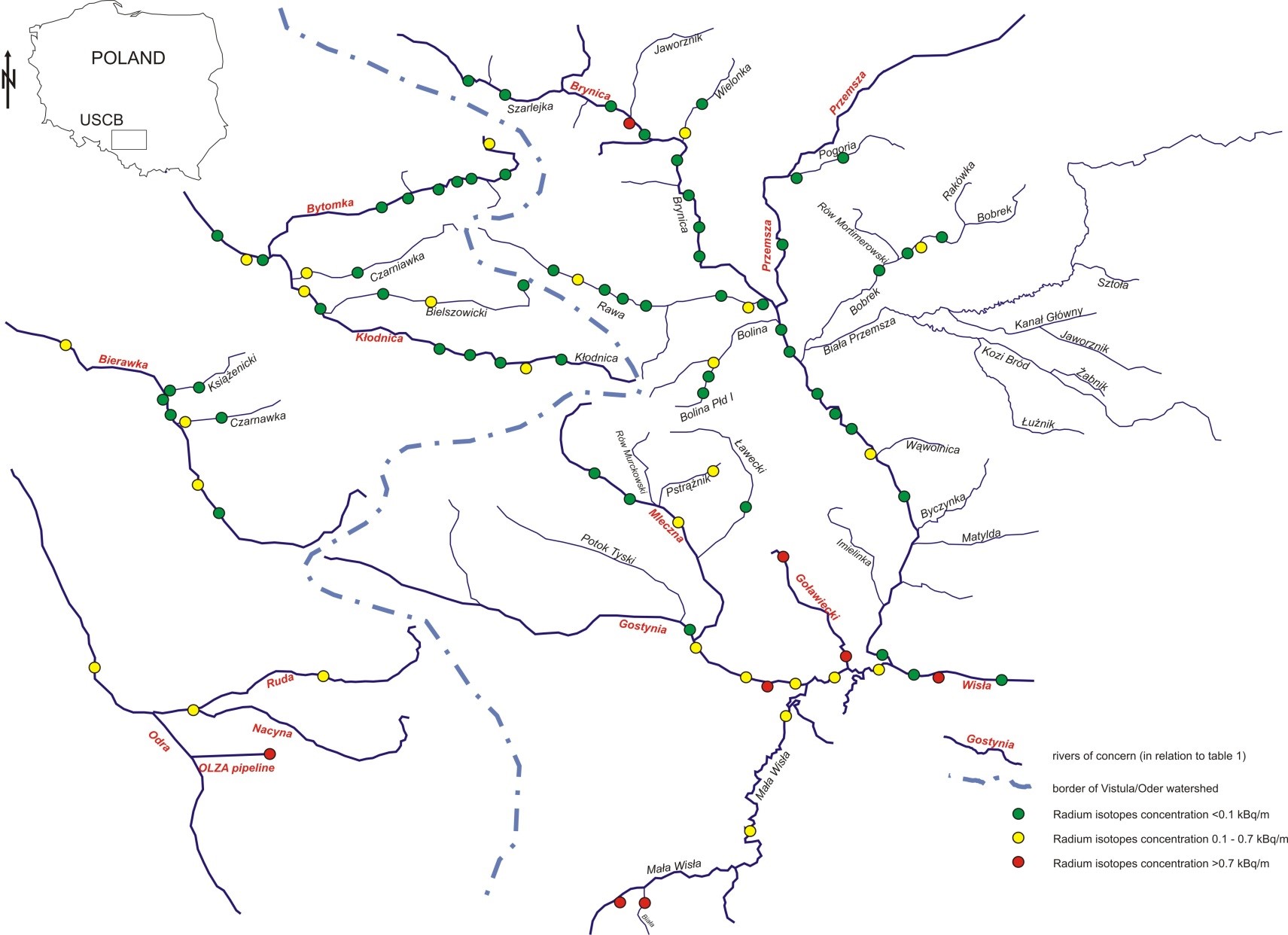
Mine water discharging points to local rivers and finally in to Vistula river or via OLZA pipeline into Oder river (click to enlarge)
Site 1: Upper Vistula river, a natural river which is affected by the continuous discharge of mine brines with high activity levels of radium over a length of about 60 km.
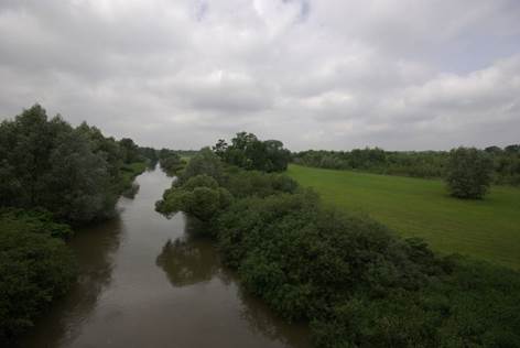
Site 2: Former mine settling pond Rontok Wielki (surface area 32 ha), is a natural pond that was adapted in the past as settling and retention pond for mine waters. It is currently excluded from technological processes and filled with freshwater. Site characterisation and ALLIANCE activities at Site 2.
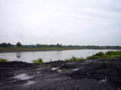
Site 3: Mine settling pond Kaniów (surface area 4.5 ha), is an artificial pond that is currently used for clearing mine waters from suspended matter and discharging saline waters into the Vistula river in a controlled way. The bottom and banks are sealed by special waterproof membrane and reinforced by concrete blocks. Due to the high content of chlorides and sulphates the presence of biota is limited.
Site 4: Formerly a natural pond, Bojszowy (surface area 16 ha) was used as mine settling pond for more than 20 years. After technical land reclamation, radium-rich bottom sediments were covered with a layer of an inert material. Currently the area is not used. The biota present is a secondary succession typical of the surrounding areas however, it is slightly different due to the amount of salt still present. There is the possibility of radium and its decay products migrating from the site. Archive data about spatial radium distribution in sediment are available, see the site characterisation.
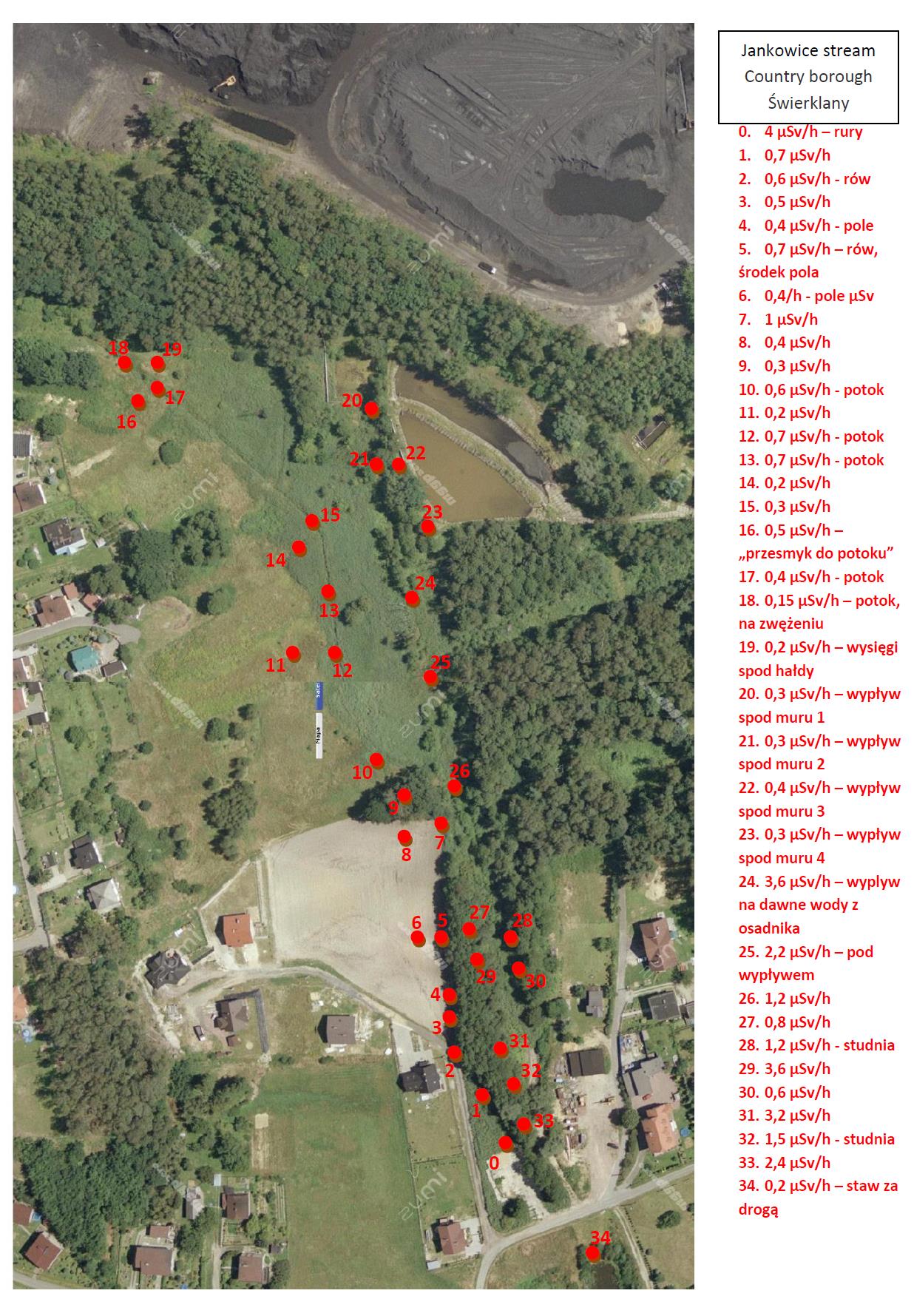
Site 5: Country borough Świerklany, a residential area, arable land and wasteland is contaminated by radium over a length of about 2 km along a former stream bed. The source of contamination is a small stream into which mine water was previously discharged for many years. The stream bed has been cleaned many times, the bottom sediments being removed and placed in the vicinity of the stream banks. (click image to enlarge for clarity)

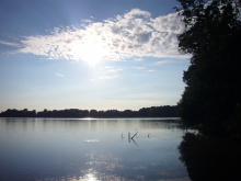
Site 6: Small (about 4.5 ha) natural lake adapted as a mine water settling pond (Boguszowice Stare, Rybnik) which is still in use. High radium isotopes activity concertation are present in water and in bottom sediments reaching 70 kBq/kg and 25 kBq/kg of Ra-226 and Ra-228 respectively. Aquatic biota are limited due to high chlorides and sulphates concentrations, however biota typical for this region occupy the lake banks.
ALLIANCE activities at the Upper Silesian Coal Basin sites
Training courses focussed on Naturally Occurring Radioactive Material (NORM) in the environment have been run in the USCB Observatory (see https://www.concert-h2020.eu/en/Concert_info/Education_Training and https://radioecology-exchange.org/content/gig-scrs).
ALLIANCE member, Silesian Centre for Environmental Radioactivity (GIG), is involved in a routine monitoring programme of mine water and the current conditions in the most affected settling ponds. Some of this data related to mine waters and sediments is available in various publications. Recent research activity is focused on radium immobilisation/mobilisation, water purification, land reclamation and sediment re-use.

ALLIANCE members Institut de Radioprotection et de Surete Nucléaire from France and Główny Instytut Górnictwa (Central Mining Institute (GIG)) from Poland co-operated in the named “Monitoring of RAdium and thallium in the vicinity of Mining SitES, “RAMSES” (01.07.2014 – 30.07.2016 ) project. The RAMSES project studied radionuclide transfers through the aqueous pathway in the vicinity of coal mining sites in order to identify radium source terms and mechanisms controlling its mobility. The investigation was focused on water and sediment characterisation to better understand the fate of Ra through aqueous interfaces in the vicinity of mining sites. Two pilot sites were chosen for sampling and investigation: the hyporheic zone of a river adjacent to a settling pond and the water-sediment interface in a lake which was formerly used as a settling pond. A wide range of measurements were performed, both in situ and in radiochemical and chemical laboratories. Contact persons: IRSN: Mathilde Zebracki, GIG: Małgorzata Wysocka
Publications
Publications on studies at the upper Silesian Coal Basin sites.
Future activities
The Polish Observatory site provides the opportunity to investigate a variety of very specific research questions, e.g. different temporal stages of settling ponds (in operation, post-operational phase, after remediation measures). However, the sites do not provide large-scale terrestrial Observatories with high radium levels as expected. Efforts to identify alternative terrestrial ecosystems that are contaminated with high levels of naturally occurring radionuclides and suitable for hypothesis-based field investigations have not yet been successful. The major problems for studies at the site are the lack of a long-term research progamme and access restrictions.
Page last updated: Apr/May 2020